Aéroports
Aéroports :
Lebanon
Albany
Allentown
Andover
Auburn / Lewiston
Augusta
Barre / Montpelier
Bedford
Belmar / Farmingdale
Bennington
Berlin
Beverly
Binghamton
Block Island
Boston
Bridgeport
Burlington
Caldwell
Chatham
Chester
Coatesville
Comté de Franklin
Comté d'Ocean
Concord
Danbury
Doylestown
East Hampton
Elmira / Corning
Falmouth
Farmingdale
Fitchburg
Fort Drum
Fort Indiantown Gap
Frelighsburg
Fryeburg
Fulton
Gatineau
Glens Falls
Greenville
Groton / New London
Harrisburg
Harrisburg / Middletown
Hartford
Hazleton
High Falls
Hyannis
Islip
Ithaca
Jaffrey
Keene
Kingston
L Acadie
Laconia
Lancaster
L'Assomption
Lawrence
Lebanon
Lennoxville
Linden
Lyndonville
Manchester
Marshfield
Massena
Meriden
Milton
Montauk
Montgomery
Monticello
Montréal
Montréal-Mirabel
Montréal Trudeau
Mont Washington
Morristown
Morrisville
Mount Holly
Mount Pocono
Nantucket
Nashua
Newark
New Bedford
Newburgh
New Haven
Newport
Newport
New York
New York
New York / JFK
New York / LaGuardia
North Adams
North Kingstown
Norwood
Orange
Ottawa
Oxford
Pawtucket
Philadelphie
Philadelphie
Philadelphie / Blue Bell
Pittsfield
Plattsburgh
Plymouth
Plymouth
Portland
Portsmouth
Pottstown
Poughkeepsie
Providence
Provincetown
Quakertown
Reading
Rochester
Rockland
Rome
Rutland
Saint-Anicet
Sainte-Anne-de-Bellevue
Sainte-Clotilde
Saint-Hubert
Sanford
Saranac Lake
Schenectady
Selinsgrove
Sherbrooke
Shirley
Somerville
Springfield
Springfield / Chicopee
St. Johnsbury
Sussex
Syracuse
Taunton
Teterboro
Trenton
Varennes
Vineyard Haven
Watertown
Waterville
Westerly
Westfield / Springfield
Westhampton Beach
Whitefield
White Plains
Wilkes-Barre / Scranton
Williamsport
Willimantic
Wilmington
Windsor Locks
Wiscasset
Worcester
Wrightstown
York
Nouvelle-Angleterre
Amérique du Nord
Delaware
Maryland
New York
Ontario, sud
Pennsylvanie
Provinces maritimes
Québec
Québec, sud
Virginie
Lebanon, New Hampshire, États-Unis latitude: 43-37-38N, longitude: 072-18-21W, altitude: 182 m
Veuillez activer JavaScript pour que cette page s'affiche correctement.
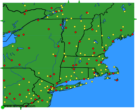
Cartes interactives des aéroports.
Les aéroports disponibles sont représentées par des disques jaunes et rouges sur la carte.
Passer la souris dessus pour voir le nom de l'aéroport.
Cliquer dessus pour voir les images.
Pour changer de carte: cliquez sur les boutons verts avec une croix noire pour zoomer, sur le bouton vert avec un tiret pour effectuer un zoom arrière, ou sur les flèches vertes pour les cartes adjacentes.